Satellite-Supported Water Efficiency in Modern Farming
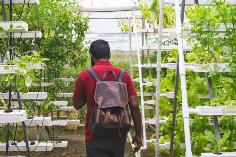
Farming has always relied on intuition—watching the skies, reading the soil, and sensing the season’s pulse. But today’s most successful farmers no longer look just to the horizon—they look to space. With agriculture increasingly threatened by water scarcity, unpredictable weather, and rising demand, a quiet revolution is unfolding above our fields: satellites are now helping farmers irrigate smarter, not harder.
According to the Asian Development Bank’s 2021 report, advancements in irrigation are gaining momentum in water‑stressed regions like Central Asia, where modernizing water infrastructure is no longer a luxury—it’s a necessity. Yet hardware alone isn’t enough. To truly future‑proof farming, producers need insights, not just infrastructure. That’s where remote sensing technologies are reshaping the rules of the game.
Today, high‑resolution, multi‑band satellite data is being used not only to monitor vegetation but to diagnose stress, measure water loss, and even forecast yields. Systems like EOS Data Analytics (EOSDA) offer platforms that combine satellite imagery for agriculture and real‑time visuals with in‑field sensors, turning fields into dynamic digital maps. The result? Farmers can pinpoint where crops are under stress or where soil is drying out, sometimes before symptoms are visible to the eye.
At the same time, new academic studies demonstrate soil‑level decision‑making with precision capabilities comparable to leading commercial systems. For example, capacitive soil moisture sensors calibrated against gravimetric measurements achieved R² values of 0.91–0.93 and were integrated into an automated drip irrigation system using Arduino, which activated irrigation when soil moisture fell below target thresholds—delivering precise watering, conserving water, and improving yield.
Other field evaluations in arid environments found that sensor‑based intelligent systems maintained soil moisture within optimal ranges and responded quickly to moisture variation. With correlations (R²) between sensor readings and gravimetric soil moisture at 0.96–0.98, these systems supported precise irrigation scheduling and significant water savings.
These technologies are doing more than optimizing farming—they’re protecting the world’s most essential resource. Satellite programs like NASA’s GRACE have exposed alarming groundwater loss in northern India, prompting new conservation policies. In regions with limited infrastructure, global platforms like FAO’s WaPOR and NASA’s SERVIR offer free, real‑time agricultural satellite data, democratizing access to information that once required expensive field surveys.

How Satellite-Supported Irrigation Systems Work
It all begins in the soil. In precision agriculture, moisture levels at the root zone are the most direct indicators of when and how much to irrigate. Field studies on drip-irrigated lettuce have shown that low-cost IoT capacitive sensors can dramatically optimize this process. These sensors—installed directly in the soil—monitored real-time moisture fluctuations and helped farmers reduce water use by 28.8% and pumping hours by 16.2% compared to traditional weather-based irrigation schedules. Even more compelling, crop water productivity jumped from 10.5 kg/m³ to 16 kg/m³—a 52% improvement—without compromising yields. Broader reviews across the U.S. agriculture sector echo these results, showing that soil-based sensor irrigation typically delivers water savings ranging from 1% to 38%, with yields equal to or better than conventional methods. However, the accuracy of this approach depends heavily on calibration, especially when using commercial-grade sensors like the TEROS 54.
From these soil-level data points, insights flow into a broader ecosystem of digital monitoring powered by satellites. Platforms like EOS Data Analytics’ Crop Monitoring bring this all together by combining ground sensor inputs with frequent, high-resolution satellite imagery. Using data from constellations like Sentinel‑2 and PlanetScope, the system produces daily crop health and moisture maps. These maps visualize problem zones, identify signs of stress early, and allow for dynamic irrigation scheduling based on real-time conditions.
In Chile, for instance, EOSDA’s platform now informs over 80% of irrigation decisions, with farmers leveraging multispectral analytics captured up to four times a day. In California, Gradient Crop Yield Solutions relies on the same system across 26,000 acres, using it to align NDVI readings with field-level moisture sensors. The result? A 10–15% cut in irrigation costs and significant energy savings, while maintaining healthy yields.
Together, these systems form a layered decision-support chain: sensors in the soil collect micro-level data, which is interpreted and amplified by macro-level satellite imaging. The outcome is smarter irrigation—more precise, more efficient, and deeply responsive to what crops actually need, from the ground up.
Case Studies: Research‑Backed Real‑World Stories
- Sensor‑Driven DSR Irrigation at IRRI (India): According to a report by The Times of India, researchers at the International Rice Research Institute (IRRI) in eastern Uttar Pradesh used soil moisture sensors, water depth monitors, and drone-based mapping to define precise soil moisture thresholds for direct-seeded rice. By coordinating agronomists, GIS experts, and water scientists, the team developed localized advisories to boost water-use efficiency and climate resilience for smallholders.
- Smallholder Farms in Ethiopia: A 2022 study by Conlon et al. mapped smallholder irrigation in Tigray and Amhara using Sentinel‑2 and MODIS satellite data and deep learning models, detecting irrigation with 96–98 % accuracy. They observed a 40 % decline in irrigated land between 2020 and 2021 due to conflict and environmental stress, highlighting remote sensing’s power where field surveying is limited.
Learn More: Waste of Water: Figures, Causes, Impact, and Sustainable Solutions
What Research Shows
- Bassine et al.’s 2023 review highlights how AI, IoT, and remote sensing enhance yield forecasting and water management, critical for achieving SDGs like Zero Hunger.
- 2021 research on self-supervised deep learning models achieved significant improvements in irrigation detection, boosting precision and recall by 90% and 40%, respectively.
- Deep learning surveys (Victor et al., 2022) show DL methods consistently outperform traditional ones for segmentation and yield prediction, though benchmarking remains inconsistent

Barriers to Scaling Smart Water Management with Satellite Technology
1. Connectivity Limitations
Many rural farmers and local water managers still struggle to access cloud platforms or real‑time satellite analytics due to weak or unreliable internet connections. A 2023 World Bank review on digital transformation in Africa highlights that only 36% of the continent’s population had access to broadband in 2022, up from 26% in 2019, but still leaving a significant digital gap.
Even where mobile broadband signals are available, affordability and infrastructure gaps remain severe:
- In least-developed countries (LDCs), 76% of the population is covered by a mobile broadband network, yet only 25% actually use the Internet, according to the ITU’s 2021 report on LDC connectivity.
- The average cost of 1 GB of mobile data in Sub-Saharan Africa was about 5% of monthly GNI per capita in 2021, far exceeding the UN affordability target of 2%
This digital divide significantly hampers the adoption of satellite-based water tools that require reliable, high-speed internet to function effectively.
2. Infrastructure Cost Hurdles
Installing sensors, cloud platforms, and integrating high-frequency satellite feeds isn’t cheap. A global agriculture study confirms that smallholders often can’t afford the upfront costs or technical complexity needed for smart irrigation systems . Meanwhile, World Bank data shows annual water infrastructure spending in developing nations needs to almost triple—from ~$165 billion—to close the gap. Without subsidies or public-private partnerships, scaling is out of reach for many.
3. Policy Mismatch & Bureaucracy
This is where it gets political. Technology is racing ahead, but regulations and policies lag. Fragmented water policies and slow bureaucratic processes slow adoption, especially in developing countries. Too often, farmers are left navigating a maze of outdated rules when trying to implement new tech.
Why It Matters
Over 40% of the global population faces water scarcity—a figure projected to rise sharply by 2030 . We can’t tackle that with clever satellites alone. We need affordable hardware, reliable internet, and forward-thinking policies. More than funding, success demands real collaboration: government, tech companies, and researchers all working together in sync.
In short, satellite tools are powerful, but without connectivity, capital, and policy alignment, they stay underused dreams.
The Future of Smart Irrigation
Smart irrigation is evolving fast, and satellites are taking center stage. As satellite imaging becomes sharper and more frequent, farmers can now see exactly where to apply water, whether it’s measuring soil moisture, detecting dry spots, or keeping tabs on water levels in rivers and reservoirs.
1. Next‑Gen Sensors & Satellites
Hyperspectral satellites, which capture hundreds of light frequencies, are moving from theory into practice. India’s Pixxel launched its first three commercial hyperspectral satellites in early 2025, with plans to expand to six and then 18 by 2026, promising 5 m resolution data across 250+ bands tailored for agriculture and environmental monitoring. Germany’s EnMAP mission, launched in 2022, offers global hyperspectral imagery every four days, helping map soil and crop characteristics with greater accuracy.
2. AI‑Driven Alerts
On‑farm AI systems are becoming more intelligent. A recent review highlights how machine learning, computer vision, and IoT sensors combined enable real-time monitoring of plant and soil health, with adaptive irrigation that reacts to immediate conditions. In parallel, neural networks now predict drought months ahead using satellite data like NASA’s AIRS metrics. Another study shows AI models detect drought stress in plants visually, triggering alerts when plants first enter stress stages.
3. Open‑Source Platforms
Global initiatives like NASA’s SERVIR and FAO’s WaPOR are expanding their reach, providing free satellite data and GIS tools worldwide. Meanwhile, commercial providers like Pixxel are making hyperspectral insights available even in resource-limited areas.
With collaboration among farmers, scientists, and policymakers, satellite‑guided irrigation is poised to become the norm. It’s a powerful strategy to secure stable food production while adapting to unpredictable climates, helping farmers water smarter, not more.
Actionable Advice for Farmers & Stakeholders
- Start small: Pilot a soil sensor system on a representative farm plot. Scale gradually.
- Blend data sources: Combine in-field sensors, satellite indices, and local weather forecasts for robust decision-making.
- Engage experts: Agronomists can bridge data insights and field interventions effectively.
- Watch costs: Evaluate ROI: e.g., 30% water savings + 15% yield gain = strong payback on tech investment.
- Build partnerships: Team up with ag-tech firms, universities, and NGOs to access training and infrastructure support.
Learn More: How Does Industrial Agriculture Promote Farming Techniques that are Ecologically Destructive?
Final Takeaways
IoT sensors + satellite imagery form a powerful duo in precision irrigation—balancing water usage with yields. Academic research shows calibrated soil moisture sensors and low-cost IoT systems deliver measurable savings and productivity gains comparable to high-end commercial solutions. AI and remote sensing enhance these systems further. Challenges—connectivity, cost, bureaucracy—must be tackled systematically. The future is tech‑enhanced, but built on solid, research‑based models. Start small, calibrate sensors properly, partner broadly, and scale with purpose.
Conclusion
In a world facing intensifying water scarcity and increasing food demand, satellite-supported irrigation offers a pragmatic, scalable solution, grounded in data and proven in the field. But the true gain lies at the intersection of technology, human expertise, and policy support.
To join the vanguard of efficient, sustainable agriculture, start by evaluating sensor-satellite platforms with clear ROI. Focus first on water savings, but watch closely: Smarter irrigation ripples across fertilizer use, energy costs, and yield quality.
The tools are here—what remains is taking the leap.